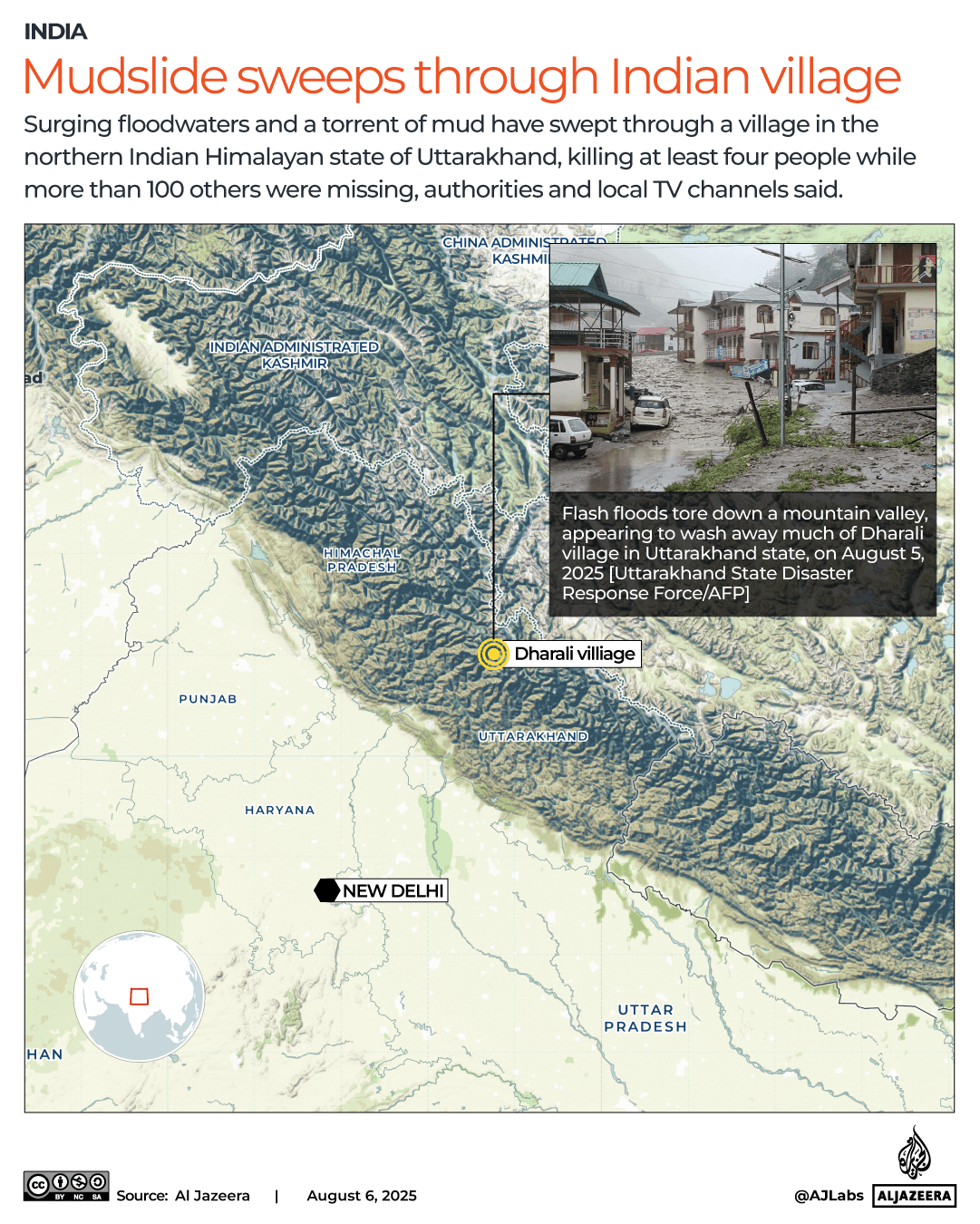
More than 100 people are missing and at least four people have died after flash floods swept through the village of Dharali, in the north Indian state of Uttarakhand.
Teams from the army and disaster response forces are operating in the area to rescue people trapped under debris, local authorities have said.
“A massive mudslide struck Dharali village in the Kheer Gad area near Harsil, triggering a sudden flow of debris and water through the settlement”, the Central Command of the Indian Army said in a post on X.
Flash floods in Uttarkashi, where Dharali is situated, were triggered by intense rainfall known as a “cloudburst”, which caused the Kheerganga river to swell, at around 1: 30pm local time (08: 00 GMT) on Tuesday.
The India Meteorological Department (IMD) warned that heavy rainfall will continue for the next few days.
What is a cloudburst?
A cloudburst is an intense downpour that delivers a large volume of rain in a short time. It is often accompanied by thunder and hail and can cause flash floods.
At any given time, clouds blanket about 70 percent of the Earth’s surface.  , Cloudbursts are often associated with cumulonimbus clouds, which contain large amounts of water.

The , IMD said that over the past 24 hours, extreme rainfall of 21cm (8.3 inches) or more had been recorded in parts of northwest India, including Uttarakhand, where the flash floods happened – more than the 10cm (3.9 inches) of rain per hour required to be classed as a cloudburst, according to the IMD.
Cloudbursts tend to occur over a small geographical region of 20 to 30 square kilometres (7.7 to 11.6 square miles)
Is this caused by climate change?
Uttarakhand, which has a large amount of mountainous and often unstable terrain, is prone to monsoon-related flooding. Dharali village is nestled in the Himalayas between the villages of Harsil and Gangotri.
Uttarakhand is particularly vulnerable to climate change given the fragility of the Himalayan region. In particular, it is exposed to excessive precipitation, cloudbursts, flood events and periods of very cold weather (cold waves), according to a study published in the International Journal of Disaster Risk Reduction.
That study found that districts in higher regions are more exposed to these effects because of their inability to adjust to weather-related and climate changes and because the ecosystems in these areas are more sensitive to such changes.
According to experts, mountain temperatures will rise more quickly than the average due to global warming.
As temperatures rise, which is closest to Dharali, will become more frequent, causing catastrophic flooding that has historically affected Uttarakhand.
Source: Aljazeera
Leave a Reply